|
|
 |
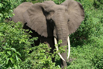
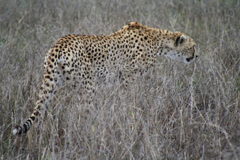
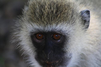
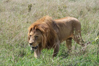
Mt. Kilimanjaro, Nov. 26 – Dec. 02, 20082008-12-15. Ravil Chamgoulov  There were seven of us in the group, all from Vancouver. That was a fundraising climb, and each of us had raised something from several hundreds dollars up to $4,000 dollars to benefit the BC Cancer Foundation. The mountain at 5,895 m/19,340 ft is the highest in Africa, and as any big mountain it has numerous climbing routes. The choice is from a very technical one to a “normal” route, which is kind of a hiking with some scrambling. However it is a high-altitude hiking and proper organization and acclimatization are mandatory for success. It was my third climb of Mt. Kilimanjaro. Last year I climbed it twice- once a Machame route with a group of fundraisers in six days, and once- more technical Arrow glacier route solo in two days. This year we were going to climb the mountain via normal Machame route in seven days to give people more time for acclimatization. Several people in the group had never been higher than 3,000 meters before. Machame route is the second most popular route on the mountain, and the most beautiful one. To climb it you will traverse halfway around the mountain and hike about 35 miles. The route goes through several different climate zones, starting from tropical jungle, followed by the rocky slopes with unusual vegetation, and finishing with the giant glaciers at the end. The beauty of this mountain is amazing. We started our climb at the Kilimanjaro National Park entrance. The trail went inside the tropical forest of rubber trees and giant fig trees. After a while, the forest gave way to tall grasses with begonia flowers and giant heather, and led us to Machame hut campsite- our first camp at 3,000 m. Next day our path followed along a steep rocky ridge passing through heather and open moorlands and crossing the Shira Plateau. In about 6 hours we reached Shira Camp at 3800 m. Everybody felt good except of Karen. Next day Karen got really sick and at Baranco camp she had finished her climb and descended via Umbwe route to Arusha with a local assistant guide, a second cook, and one porter. I used this route last year as the approach to Arrow glacier. The next three days we were hiking along the South Circle- the trail that connects several approach routes at the elevation around 4,000 m. That gave us enough time to adjust out bodies to altitude. The trail has many ups and downs, which is good for acclimatization. We climbed Lava Tower at 4,600 m. and descended to Grand Barranco canyon at 4,000. We scrambled up a steep Barranco Wall. We crossed many small streams before crossing the Karanga River just before Karanga camp. It was accompanied by great views of the mountain from all angles. By the end of the fifth day we reached Barafu campsite (4,600) - our last camp on the way. I need to say a few words about the local people, who helped us during the climb. Tanzanian government requires that climbers have to hire local guides and porters. For seven climbers in our group we had twenty local people who carried loads, cooked food, and accompanied us on the trail. That created very unusual comfort on the mountain. The porters work really hard for very little money. It’s a poor country. The guides are very good in managing their team, and they know the mountain very well, though they have some limitations. As a rule they never had any special mountaineering training, they never used crampons or ice axes, and climb only normal routes of only one mountain. Some notes about the weather on Kilimanjaro. The mountain is climbable all around the year, though there are two rainy seasons, which are better to be avoided. We climbed it right after the short rainy season, the same time as my last year climbs. Weather is very important factor in the mountains and I always try to understand the ideas of local mountain weather. I guess I found the weather pattern on Kilimanjaro at least for that period of year. The mountain is so big, that it creates its own weather. Usually at night and in the morning it is clear and nice. With the sunrise, the tropical forests and dense vegetation at the bottom of the mountain start to evaporate, and by noon the mountain is covered by a layer of clouds with possible fog and scattered showers. Have to say that it worked that way almost all the time, with bright sunny mornings and foggy afternoons. On the sixth day, to be exact, on the sixth night at 12 pm we began our summit push. By 6 am, when the sun started to lit glaciers with a pink pre-dawn color, we reached the edge of the summit crater at Stella Point. From that spot it was only about 30 minutes to the top of the summit, and soon all six of us were standing on Kibo peak (5,893 m)- the highest single peak of Mt. Kilimanjaro. We spend half an hour on the summit, and then discended a long way to 3,000 m. Mweka camp via Mweka route. Next day we descended to the town of Arusha, where we united with Karen and went to safari.
Please log in to post your comment All comments: 0 | Welcome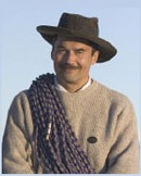 Dr. Ravil Chamgoulov is an elite world-class high-altitude climber who was awarded the rare and prestigious Soviet Union designation of ‘Snow Leopard’. High-altitude ... | ||||
|
| |||||
| |||||